Wednesday, 21 Jan 2026
Red Squirrel Appreciation Day falls on the 21 January this year and we're sharing some of our favour…
Work is commencing Monday 5 January 2026 to resurface part of Pine Cone Point Trail. This will take around four weeks to complete and the trail will be closed throughout this period. The Torryvald Trail will remain open as usual.
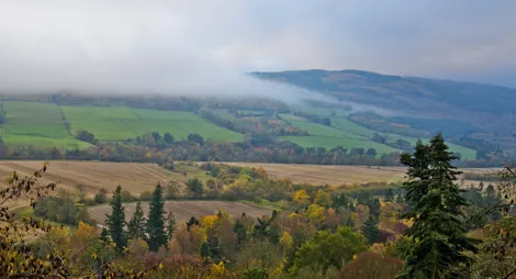
Craigvinean was one of the first of the Big Tree Country forests, and one of several planted by the Dukes of Atholl. It became a popular place in Victorian times: early visitors delighted in the forest paths leading to follies and dramatic viewpoints. Now you can follow the trails to discover the same stunning views over Dunkeld and the mighty River Tay.
Discover the Victorian-inspired Torryvald folly hidden deep within the varied forest.
Wide, firm gravel path with narrow rocky sections. Some short, fairly steep slopes.

Allow ¾ Hour
Victorian visitors loved ornate follies – fanciful buildings with no practical purpose, designed just for the pleasure of seeing them in the landscape. The Torryvald folly you'll find on this trail today stands in the place of a ruined Victorian viewpoint. It's named after a long-deserted township that lay to the north.
Work is commencing Monday 5 January 2026 to resurface part of Pine Cone Point Trail. This will take around four weeks to complete and the trail will be closed throughout this period. The Torryvald Trail will remain open as usual.
Weave your way through the forest to a unique shelter with spectacular views over the River Tay.
Wide, firm and largely smooth gravel surface, with some uneven sections. Long moderate slope for 600m with some steeper sections.

Allow 1 ½ hours
Look out for pine cones by the trail that have been nibbled down to the stalk. It's a sure sign that red squirrels are about, and at the high point of the trail, a giant pine cone is waiting for you. The views from here across the Tay to Dunkeld and to the mountains in the north are magnificent.
The fixed orienteering course at Craigvinean is a great way to try this popular sport, in which you hunt for check points using a detailed map. If you’d like to have a go, get in touch with Scottish Orienteering for a map of Craigvinean, grab a compass and head for the trees.
The nearest public toilets are in Dunkeld, where you'll also find a wide variety of shops and places to eat.
There is no charge to park in this car park. Please park with care and consideration. In particular please park in designated parking areas only and do not block entrances or gates.
Craigvinean is 1 mile west of Dunkeld. Turn off the A9 at the sign for The Hermitage. This road immediately swings to the right, reaching the easy-to-spot car park for Craigvinean after 250 meters. You can also park in the National Trust for Scotland Hermitage car park where parking charges apply.
PH8 0JR is the nearest postcode.
Have a question or suggestion for improvement?

A handy stopping point just off the A9 near Dunkeld.

Climb to an Iron Age hillfort with views over Strathtay

Look for hidden sculptures in this hillside wood