
Thursday, 25 April 2024
Many don’t realise that Scotland is home to a native apple species, the wild apple (Malus sylvestris). Due to hybridisation, and historically being seen as unimportant the nat...
The Caisteal MacTuathal Trail and the Taymouth Trail are currently closed due to storm damage.
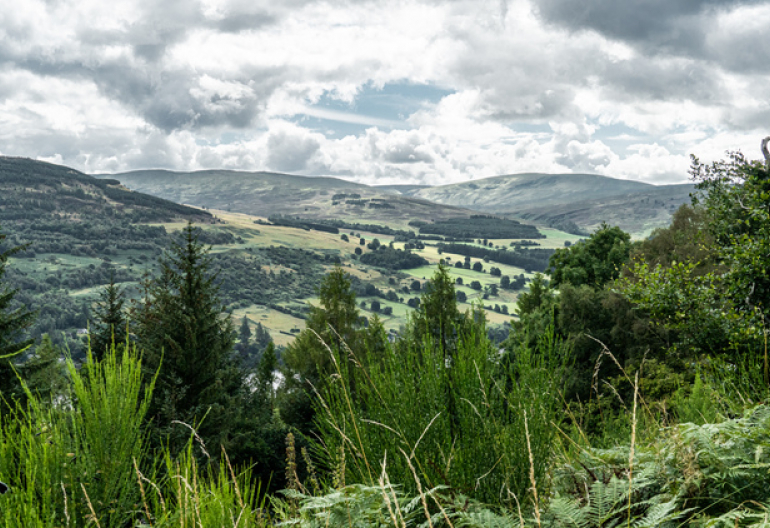
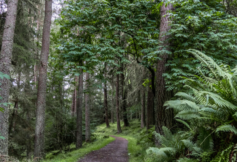
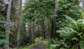
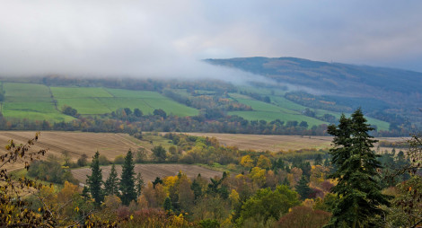
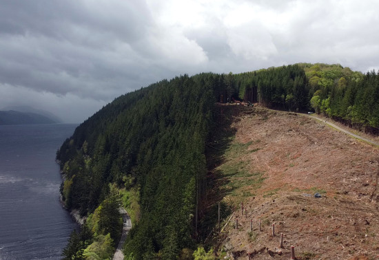
Drummond Hill was probably Scotland’s first managed forest. Sir Duncan Campbell, known as Black Duncan of Breadalbane because of his ruthless character, planted it with oak, birch and Scots pine back in the 17th century. Now it’s a rich habitat that’s home to lots of wildlife, and part of the fascinating heritage of forests that make up Perthshire’s Big Tree Country.
Keep a look out for the boar carvings in stones that mark one of the walks here – they’re based on the boar of the Clan Campbell’s crest.
Drummond Hill route card (PDF)
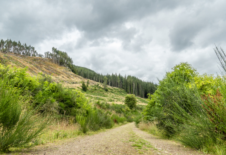
Explore the mature beech woodland on the slopes of Drummond Hill.
Mostly wide, uneven gravel surface. Some short earthy sections with exposed tree roots. Long moderate slopes for 3/4 mile with some steep sections. Parts may be muddy.
Allow 1½ hours
Terrain description
Gravel forest roads, and gravel and earth paths. Narrow and muddy in places, with long moderate slopes.
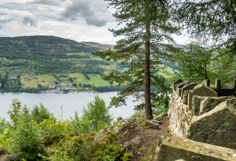
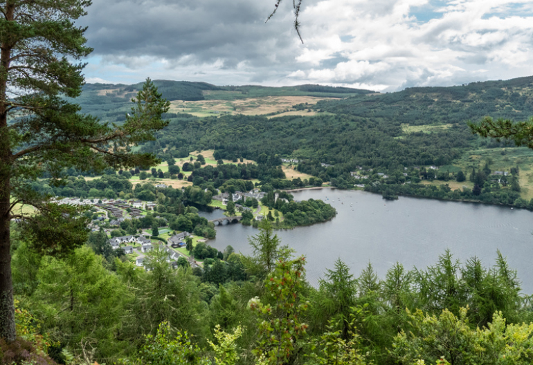
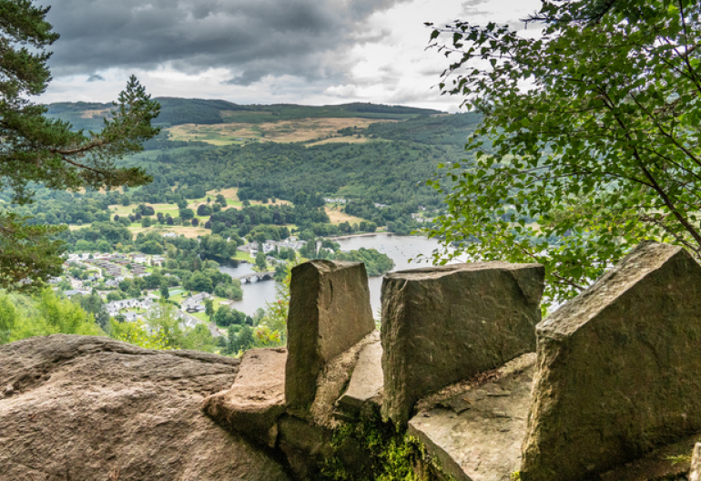
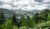
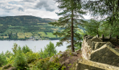
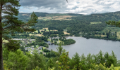
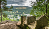
Zigzag steadily up through the beech and larch forest to Black Rock viewpoint for stunning views over Loch Tay.
Wide, uneven gravel surface throughout. Long moderate slopes for up to a mile with some fairly steep sections.
Allow 2 hours
The Caisteal MacTuathal Trail is closed due to windblown trees over the path.
A superb circuit of Drummond Hill, taking in the remains of an Iron Age hill fort and some wonderful views over Strathtay and Glen Lyon. Follow the stone boar carvings.
Largely wide, uneven gravel surface. Section of rough, narrow earth and grass path with rocky parts. Some long steep slopes. Short patches may be muddy.
Allow 4 hours
This Pictish hill fort was named after Tuathal, the son of a 9th century Abbot of Dunkeld. With its clear views to north and south, it's easy to see why this site was part of a network of look-out points. From the fort you can retrace your steps or continue round the full circuit.
There are public toilets and a cafè at the Mains of Taymouth courtyard in Kenmore.
We are trialling an extension of Stay the Night to run over winter this year. This means motorhomes and campervans that are self-contained and have their own toilet facilities will be able to stay overnight at this car park.
There is a £7 charge to Stay the Night at all participating car parks. Payment can be made through RingGo with details of how to do this at each car park.
To help plan your stay, please see the details below:
Please visit our Stay the Night page for full details, participating locations, best practice, and terms and conditions of use.
There is no charge to park in this car park. Please park with care and consideration. In particular please park in designated parking areas only and do not block entrances or gates.
Drummond Hill is a ¼ mile from Kenmore at the east end of Loch Tay. Look for the sign for 'Drummond Hill Forest Walks' from the A827 as it passes through the north of the village.
PH15 2HN is the nearest postcode.
Infrequent local buses stop at Kenmore, a ¼ mile walk from the forest entrance. Plan your journey at Traveline Scotland.
Have a question or suggestion for improvement?
Look for hidden sculptures in this hillside wood
Look for hidden sculptures in this hillside wood
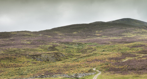
Begin your ascent of Schiehallion
Thursday, 25 April 2024
Many don’t realise that Scotland is home to a native apple species, the wild apple (Malus sylvestris). Due to hybridisation, and historically being seen as unimportant the nat...
Thursday, 18 April 2024
An ancie...
Thursday, 11 April 2024
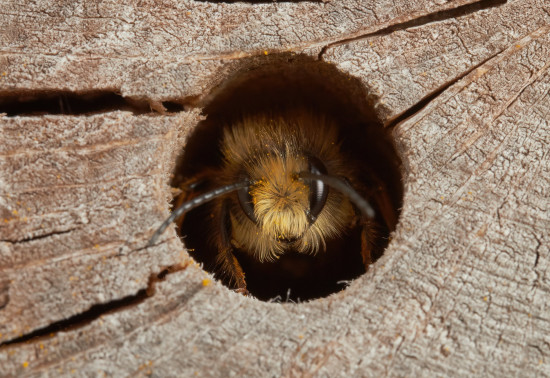
Around 270 species of bees are found in the UK, with nearly 90% solitary species. Some that can be seen in Scotland include the red mason bee, common carder bee and the chocolate mining bee that...
Thursday, 04 April 2024