Wednesday, 21 Jan 2026
Red Squirrel Appreciation Day falls on the 21 January this year and we're sharing some of our favour…
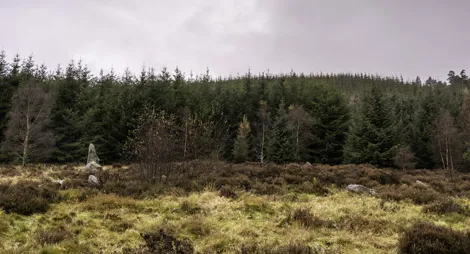
Spilling down the northern slopes of the hill is the forest at Back O’Bennachie. There’s a large, open picnic area where you can have a barbecue.
On the hillside above the forest you can find the remains of the quarry that supplied stone to build local villages. There’s also a superb circuit that takes in three of Bennachie’s summits.
Back o' Bennachie route card (PDF)
From a fresh green burst in spring to an autumn blast of gold, the larick (larch) here provides a different colour for all the seasons.
A moderate to fairly steep trail, with varied surfaces: firm forest roads, earthy paths that can be muddy and rough sections with rocks, roots and large steps.

Allow 1 hour
The trail passes through native, naturally-growing trees like Scots pine, as well as forest planted with other species chosen for their timber value.
A great workout on the hill, visiting the Mither Tap and Bennachie’s highest summit - Oxen Craig.
A very steep, rough trail with long climbs, large steps, rocky and some areas on the summits which may be muddy.

Allow 3 ¾ hours
The longest route to the landmark of the Mither Tap, this trail also visits Bennachie’s highest summit at Oxen Craig. On the way you’ll pass the old quarry at Little Oxen Craig, where stone was cut in the 1800s to build houses in nearby villages. Watch out for the sculpture installed here.
It may not be a Munro, but climbing Bennachie can be a real mountain experience with real mountain dangers. Ice and snow make the paths extremely hazardous in winter and spring. Even in summer the wind blows constantly at the top and temperatures will drop suddenly in rain. Don’t get caught out - dress warmly, take boots and waterproofs and be prepared to turn back when the weather changes.
The toilets here are open from 1 April to 31 October. You’ll find places to eat in Oyne, Chapel of Garioch and Inverurie.
The charges to park at Back o' Bennachie are:
Blue Badge holders park free. Please display your Blue Badge clearly.
Payment can be made using coins or RingGo.
Annual parking passes are available for this site, visit our parking page for more information.
Please park with care and consideration. In particular please park in designated parking areas only and do not block entrances or gates. Nearby car parks with free parking can be found in our Forest Search.
Our Stay the Night scheme now runs right through the year. This means self-contained motorhomes and campervans will be able to park overnight for one night in some of our car parks.
There is a £10 charge to Stay the Night at this car park. Payment can be made through RingGo with details of how to do this at the car park.
To help plan your stay, please see the details below:
Please visit our Stay the Night page for full details, participating locations, best practice, and terms and conditions of use.
Follow the A96 north from Inverurie for about 7 miles (11.2 km). At the Oyne Fork turn left onto the B9002, signposted to Insch. Follow this road through Oyne village for about 2 miles (3.2 km), then turn left on a narrow road signposted ‘Back o' Bennachie Forest Walks’. The car park is about 1 mile (1.6 km) up this road.
Nearest postcode: AB52 6RH
Buses serve Oyne village, about 1 ¾ miles (2.8 km) away. Check Traveline Scotland for details.
Have a question or suggestion for improvement?

The best place to start for Bennachie first-timers

The best views of Bennachie on a quieter walk to the summit

Walking and mountain biking across granite hilltop trails