Wednesday, 21 Jan 2026
Red Squirrel Appreciation Day falls on the 21 January this year and we're sharing some of our favour…
If you're looking for a mountain bike challenge, or peaceful walks to a pond where beasties lurk, this hidden gem is worth seeking out. You can explore its sunny forest glades and high rocky slabs on bike, foot or horseback. There's a sense of wild country on the tops, with views west and east over the hills, while deep in the forest you'll find sheltered clearings full of wildflowers and berries.
A short climb through the pine forest to an enchanting little dipping pond.
Moderate climb to dipping pond. Narrow gravel path through trees to a wide forest road. No obstacles.

Allow ¾ hour
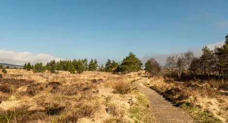
Open forest glades let the sunshine in all the way to a pretty dipping pond. In summer these woodland clearings are home to butterflies and blueberries; in winter there are views to the snowy Struie hills.
Balblair mountain biking route card (PDF)
Grade – Blue: Moderate ![]()
Expect a mixture of climbs and descents with moderate gradients, technical features like tree roots and rock steps; jumps and berms. Rollable features at controlled speed. Variable surfaces.
Soar through the trees on this twisting trail. An enjoyable quick blast through the trees for competent riders looking to improve their bike handling skills and an ideal warm up for experts attempting the Balblair Black. Work on your balance on the tight twisting sections, then let the good times roll on the smooth downhill Ceilidh Trail. Start at the second car park. Mostly wide gravel paths with some loose sections and long, gentle to moderate slopes. Can be muddy when wet.
Grade – Black: Severe ![]()
Expect a long and steep climbs, descents, and jumps. Numerous hazards including drop-offs and severe features. Rapid rate of surface change. Commitment required.
A fun and memorable black with technical rock features and fast-flowing downhill. The full, lung-busting climb up Cnoc an Tionail (knock an tinnell - hillock of the gathering) gives you spectacular views before a rock slab descent down Candy Mountain that'll test even the most courageous! Start at the second car park. The route follows the Blue Trail at the start and finish. Mostly loose gravel singletrack with sections of bare rock and boardwalk. Can be muddy and very steep in places.
Candy Mountain, Loopy Loo, and Slab & Tickle will be closed until further notice. A diversion is in place, please follow all onsite signage. See map for diversion routes.
The nearest public toilets and café are less than a mile away in Bonar Bridge. You can hire bikes from shops in nearby Ardgay and Tain.
There is no charge to park in this car park.
Balblair is 1 mile north of Bonar Bridge on the A836 road to Lairg.
IV24 3EE is the nearest postcode, on the edge of Bonar Bridge.
The nearest bus stop is in Bonar Bridge, 1 mile walk from the forest. If you have a bike, Ardgay train station is an easy 2 mile cycle away. Plan your journey at Traveline Scotland.
Have a question or suggestion for improvement?

Ancient woodland, Atlantic salmon and thundering falls

Descend down by Allt Mor burn into Raven's Rock Gorge

Ancient monuments, scenic views and gentle lochside trails