Wednesday, 21 Jan 2026
Red Squirrel Appreciation Day falls on the 21 January this year and we're sharing some of our favour…
There are harvesting works immediately adjacent to sections of the Deer Hill Trail. These works will not stop you from enjoying the trail, but may lead to some delays as staff make the site safe for you to continue. Please observe all site safety signage ad any instruction from staff.
Walk around the shore or if you fancy something more challenging climb Cnon nan Gabhar on our waymarked trail. The steep climb is rewarded with views out to Arran.
The forest is a haven for wildlife, so look out for deer, red and black grouse and many birds of prey.
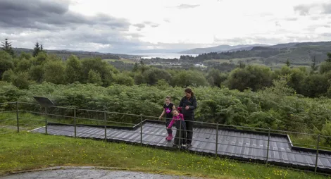
Enjoy an eagle’s eye view over Carradale Bay and Kilbrannan Sound from the rocky summit of Cnoc nan Gabhar.
Prolonged steep slopes for up to 600m. Uneven grassy paths with rough, narrow and muddy sections.

Allow 2 ½ hours
This strenuous route leads you through woodland and open moorland dotted with bright rhododendrons to the summit of Cnoc nan Ghabar. Enjoy a magnificent panorama over Carradale Glen, Kilbrannan Sound and Arran. Spot Ben Cruachan, Argyll’s highest point, to the north. This is called Deer Hill for good reason – look out for red, roe, fallow and sika deer, as well as moorland birds amongst the heather, and golden eagles and hen harriers overhead.
.
Look out for red and roe deer amongst the mature trees. Butterflies are in open sunny glades around the younger trees. These grassy areas are also home to voles, the favourite food of birds of prey like buzzards and kestrels.
Head up onto higher ground to find moorland birds amongst the heather and maybe even a golden eagle circling overhead. Beside Kilbrannan Sound you might be lucky enough to see basking sharks.
Carradale is on the route of the 100 mile Kintyre Way. This waymarked long distance trail criss-crosses the Kintyre peninsula between Tarbert and Dunaverty.
You can also explore the Kintyre peninsula following National Cycle Route 78, which passes close to Carradale.
There are public toilets and a selection of places to eat, drink and shop in Carradale and the wider East Kintyre area. There’s also a tearoom with tourist information at the Carradale Network Centre – check for their opening hours.
The charges to park at this forest car park are:
Payment can be made using RingGo.
Annual parking passes are available for this site, visit our parking page for more information.
The Deer Hill Trail starts at the Port Na Storm car park, which can be found on the left when entering Carradale village.
The north end of the forest can be accessed via Grianan car park. This can be found on the east side of the B842, half way between Dippen and Grogport.
PA28 6SB is the nearest postcode for Port na Storm car park.
PA28 6QJ is the nearest for Grianan, but about a mile south of the site.
There are regular buses from Campbeltown to Carradale. Plan your journey at Traveline Scotland.
Have a question or suggestion for improvement?

Climb above Tarbert village for views across Kintyre

Step back in time and discover 4,000 year-old rock art

Unique wetland that's home to Scotland's wild beavers