Wednesday, 21 Jan 2026
Red Squirrel Appreciation Day falls on the 21 January this year and we're sharing some of our favour…
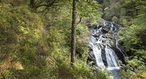
Welcome to Eas Urchaidh (Gaelic for Falls of Orchy). The perfect place to stop while you’re in the heart of Glen Orchy. View the spectacular falls or just enjoy a quiet spot for a picnic.
The car park and picnic area can be easily accessed along the B8074. This single-track road follows the River Orchy through the glen. A short walk uphill from here is a remnant of the Caledonian pinewoods which once covered much of Scotland. The wood is called Allt Braighieachan, a Gaelic name that is thought to mean Tumultuous Stream.
Explore on bicycle, by foot or by horse.
The forest roads and tracks are great fun for self-guided exploration on mountain bike, gravel bike, horseback or by foot. Ordnance Survey maps Landranger 50: Glen Orchy & Loch Etive and Explorer 377: Loch Etive & Glen Orchy cover the forest and its surrounding area.
Follow the fingerposts north from the car park, then take the surfaced public road for 0.8 miles / 1.4km. From there a path leads to the river which provides access for watersports.
The car park and picnic area at Eas Urchaidh are popular with kayakers as a put-in spot for the River Orchy. The UK Rivers Guidebook has a route description for the extremely challenging middle section.
It is also a place to park for the hill access route to Beinn Mhic Mhonaidh a sometimes forgotten Corbett.
Allt Broighleachan, one of the most southerly fragments of Scotland's Caledonian pinewood, can be accessed via the forest road near the Eas Urchaidh car park.
The Nearest Public Toilets are in Tyndrum.
To find the car park and picnic area at Eas Urchaidh, turn off the A85 approximately 2 miles east of Dalmally then follow the single track B8074 for approximately 4.5 miles.
The site can also be accessed from the A82. Turn off the A82 onto the single track B8074 just over 0.5 miles south of Bridge of Orchy village.
PA33 1BD is the nearest postcode.
Unfortunately, there is no public transport in the glen, however you can get to Dalmally by bus and train, and bridge of Orchy by bus or train. Both villages are at either end of the glen where you could walk or cycle from. The train between Oban and Glasgow often has a bike carriage. Best to check before travelling.
Have a question or suggestion for improvement?

Quiet riverside picnic site with mountain views

Quiet riverside trails in oak and birch woodland

Community woodland with short trails