Wednesday, 21 Jan 2026
Red Squirrel Appreciation Day falls on the 21 January this year and we're sharing some of our favour…
Explore stunning woodland on routes where some of Ardentinny’s first foresters planted seedlings. The beach is washed by the waters of Loch Long. Viking fleets, Gaelic raiders, wartime Commando assault boats and nuclear submarines have all been through here. A 4.75-mile (7.6 km) path leads to Carrick Castle.
Enjoy a gentle stroll and back along Glenfinart Burn to the Arched Bridge beneath exotic monkey puzzles, cypresses and firs.
Firm tarmac and gravel surface throughout, with some loose stones.

Allow ½ hour
Along the way you'll pass the old walled garden of Glenfinart House and in springtime a gorgeous range of snowdrops, daffodils and bluebells.
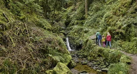
A short walk that climbs through native birch and oak woodland above the crags of Lover’s Leap, before returning down Grotto Burn.
Firm but uneven surface, with grassy and rocky sections that are narrow and potentially muddy in places. Long steep slopes for 400m and some steps.

Allow ¾ hour
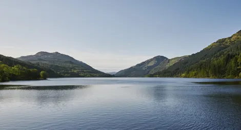
A varied route around the attractive shoreline at Finart Bay. Climb through the forest to the Laird’s Grave for great views across Loch Long.
Wide, firm tarmac and gravel surface, with some loose stones and a slightly uneven section. Some fairly steep slopes. Includes two openings 0.9m wide and a section along the road.

Allow 1 hour
The Laird's Grave dates from 1860 and is that of Archibald Douglas, Laird of Ardentinny. In the sunny fields below, a Forestry Commission nursery raised thousands of seedlings for forests throughout Scotland.
There are public toilets at the picnic site open all year round. Toilets are also available in Ardentinny village.
The charges to park at Ardentinny are:
Blue Badge holders park free. Please display your Blue Badge clearly.
Payment can be made using card or RingGo.
Annual parking passes are available for this site, visit our parking page for more information.
Head north from Ardentinny village. The car park is on the right after 1 mile, just beyond the entrance to Glenfinart Caravan Park.
PA23 8TS is the nearest postcode.
Local buses run from Dunoon to Ardentinny village. You can access the beach from the north end of the village. Plan your journey at Traveline Scotland.
Have a question or suggestion for improvement?

Walk between colourful plants and giant conifers

A deep, woodland gorge with cascading waterfalls

A picturesque picnic spot with lochside views