Wednesday, 21 Jan 2026
Red Squirrel Appreciation Day falls on the 21 January this year and we're sharing some of our favour…
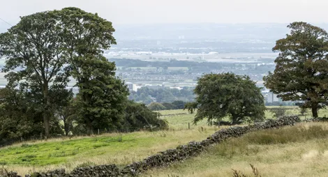
Head into the hills above Old Kilpatrick to reach tranquil Loch Humphrey. The historic hill tracks that criss-cross the Kilpatrick Hills are ideal for walking or mountain biking. Watch out for waterfalls along the way, spot waterbirds on the loch or simply sit back and soak in the views over Glasgow and the central belt.
There are no formal trails here but the forest road that climbs up to the loch is easy to follow. It is steep in places and can sometimes be quite muddy.
There are cafès and shops in the nearby village of Kilpatrick.
There is no charge to park in this car park.
Kilpatrick Braes Car Park (which is run by the local council) can be accessed from Mount Pleasant Drive. The walking route to the Kilpatrick Hills is well signposted from here.
For direct access to site (drop off only, no parking), head along Station Road, under the A82, veering left when the road forks. The site entrance is about 500 yards along this road on the right, between two old stone gateposts. Please note the tarmacked section of the route provides access to residents. For your safety, please ensure dogs and children are kept close and ensure you are aware of your surroundings.
G60 5LX is the nearest postcode for Kilpatrick Station. G60 5HN is the nearest postcode for the junction at the start of the route up to the hills.
The walking route is signposted from Kilpatrick train station. Plan your journey at Traveline Scotland.
Have a question or suggestion for improvement?

A woodland and riverside beach beneath Erskine Bridge

Grassy peak with views over Glasgow and the central belt

Explore the wild moors, crags and woods of the Kilpatrick Hills