Craik Forest

Where we are

Craik Forest Notice

From the 2nd of December 2024: The upper and lower car park and the white Burnside Trail, blue Spruce Trail and red Aithouseburn Trail are closed due to tree felling operations, seven days a week.
Please follow all site safety signage and operator's instructions. The felling work is due to last until the end of February 2025. 

About

A stunning woodland landscape with tranquil trails

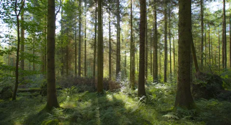
Craik Forest is great for when you want to ‘get away from it all’. Nestling in the heart of the Southern Uplands, this large, remote woodland is home to red squirrels and many woodland birds.

Some of the trees here are over 100 years old, and the size and isolation of the forest makes it a great place for wildlife.

Walking trails

Craik Forest route card (PDF)

Walking

Burnside Trail (closed)

A trail notice is in effect

Trail closed due to tree felling work. The felling work is due to last until the end of February 2025. If visiting the wider forest, please follow all site safety signage and operator’s instructions.

A short stroll along the peaceful Borthwick Water, through graceful larch. Perfect for a picnic.

Wide and firm track throughout, with occasional loose gravel. Gentle rises and one section of boardwalk.

Easy (all abilities) trail grade icon grade icon
¼ miles / 0.36 km

Allow ¼ hours

More information

Find out about the salmon that spawn in the burn, and the bats, owls and squirrels that live in the trees.

Walking

Spruce Trail (closed)

A trail notice is in effect

Trail closed due to tree felling work. The felling work is due to last until the end of February 2025. If visiting the wider forest, please follow all site safety signage and operator’s instructions.

A wee daunder along the burn and through mature, moss-clad Norway spruce trees, a favourite habitat of the red squirrel.

Uneven gravel and earth paths. Some exposed tree roots and potentially muddy sections. Two short steep slopes and a pair of bridges.

Moderate trail grade icon grade icon
½ miles / 0.8 km

Allow ½ hours

Walking

Aithouse Burn Trail (closed)

A trail notice is in effect

Trail closed due to tree felling work. The felling work is due to last until the end of February 2025. If visiting the wider forest, please follow all site safety signage and operator’s instructions.

Walk through some of Craik’s oldest trees and along the lovely Aithouse Burn. Great views over the forest.

Uneven grass and earth paths with some muddy sections. Some steep slopes. Includes a bridge and section of boardwalk.

Moderate trail grade icon grade icon
1 ¾ miles / 2.8 km

Allow 1 hour

More information

There's opportunities to spot red squirrels and woodland birds, so bring your binoculars.

Facilities and access

Viewpoint
Viewpoint
Walking
Walking
All ability trails
All ability trails
Parking
Parking
Picnic area
Picnic area

Find a bite to eat nearby

You’ll find public toilets and places to eat in Hawick.

Car parking information

There is no charge to park in this car park. Please park with care and consideration. In particular please park in designated parking areas only and do not block entrances or gates.

More about parking

Getting here

From Hawick, follow the A7 towards Carlisle. At Martins Bridge turn onto the B711, signposted for Roberton. After about 3 ¼ miles, just beyond the school in Roberton, turn left and follow the unclassified single track road for about 6 ½ miles to the car park. Craik Forest is well signposted.

Using SatNav?

TD9 7PS is the nearest postcode.

Get directions

Get in touch

Have a question or suggestion for improvement?
Phone
0300 067 6900 (option 1)
More contact information

Nearby forests

Drooping conifer branch

An Iron Age landscape with views over the River Esk

Facilities and activities
Ancient monument
Ancient monument
Viewpoint
Viewpoint
Walking
Walking
Parking
Parking
Distance from 'Bessie's Hill': 10.19 miles
Drooping conifer branch

Explore this spectacular prehistoric settlement
Facilities and activities
Ancient monument
Ancient monument
Viewpoint
Viewpoint
Walking
Walking
Parking
Parking
Distance from 'Castle O'er': 11.54 miles
Drooping conifer branch

Find space to breathe at Craigieburn

Facilities and activities
Walking
Walking
Parking
Parking
Picnic area
Picnic area
Distance from 'Craigieburn Forest': 14.25 miles