Wednesday, 21 Jan 2026
Red Squirrel Appreciation Day falls on the 21 January this year and we're sharing some of our favour…
Spend some time exploring the burnside trails and bridges of Dyemill's native woodland. You can also climb through the conifers to Urie Loch. This is where hen harriers fly low over the heather moorland.
People of the past have left traces all through this forest, from old shielings and the ruins of Lagaville to the well-known Meallach's Grave, a prehistoric, chambered cairn.
Walk up the picturesque gorge of Allt Lagriehesk to a pond near the ruins of Lagaville clearance village. An optional diversion leads to Meallach’s Grave, an impressive Neolithic chambered cairn.
Firm but uneven gravel and earth surface with narrow sections and exposed tree roots. Includes some fairly steep slopes, bridges and steps. Diversion to Meallach’s Grave is rougher and steeper.

Allow 1 hour
This pleasant trail is made up of two loops in a figure of eight, which you can do in any direction or combination. Benches invite you to rest and contemplate the forest, and there’s a wildlife pond where you can watch dragonflies in summer.
The Urie Loch Trail is closed due to multiple fallen trees.
A tough ascent through the Sitka forest to reach a scenic loch nestled amid the open heather moorland. A bird’s eye view over Lamlash Bay and Holy Island.
Rough grass and earth path with long muddy sections and some rough rocky steps. Long continuous steep slopes for over a mile.

Allow 2 ½ hours
This quiet loch sits beneath the top of Tighvein, the highest hill in the south of Arran. You might see hen harriers and red throated divers here.
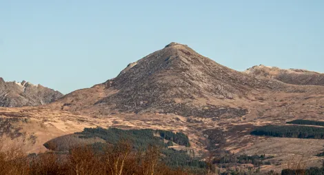
A fabulous forest cycle route with wildlife, waterfalls and views to Goatfell and Ireland.
Working forest road with some steep climbs and loose surfaces. Minor public road with one steep climb. Mountain bikes are recommended for the forest section.
Allow 2 hours
Stay on the forest roads or make a longer circular route by returning on The Ross, the minor public road between Lamlash and Kilmory. The route includes short detours to Glenashdale Falls, Meallach's Grave and other archaeological features as well as open views to Goatfell, Holy Isle and even Ireland on a clear day.
Start from Dyemill forest car park or the Aucheleffan forest entrance, one mile (1.6 km) east of Kilmory. You can also start or exit at Whiting Bay.
This is a popular place for cyclists as well as walkers. The 9-mile (14.4 km) Dyemill to Kilmory cycle route starts here, following forest roads.
The nearest public toilets are in Lamlash, where you'll also find places to eat.
There is no charge to park in this car park.
Travel by ferry from Ardrossan in North Ayrshire to Brodick and then follow the A841 south for 4 miles (6.4 km) to Lamlash. Continue for one mile (1.6 km), then turn right at Monamore Bridge towards Kilmory. The entrance to the car park is on the left.
Nearest postcode: KA27 8AR
The nearest bus stop is in Lamlash, about a mile (1.6 km) from Dyemill. You'll find timetable details at Traveline Scotland.
Have a question or suggestion for improvement?

Start exploring Arran, with cairns, standing stones and lots of red squirrels

A waterfall, a peaceful loch and lots of prehistoric sites

Explore the castle grounds and forests with views over Brodick Bay