Wednesday, 21 Jan 2026
Red Squirrel Appreciation Day falls on the 21 January this year and we're sharing some of our favour…
9 July 2025: The Glenashdale Falls Trail has a long-term diversion in place due to storm damage. The diversion is detailed on the route card here and indicated on-site through signage.
Explore the South End and enjoy scenic views, mixed woodland and the tallest double waterfall in Arran. This is great habitat for native red squirrels and one of the best places on the island to catch sight of them. The forest is full of ancient sites, including unusual horned chambered cairns, standing stones and an iron age hill fort.
There are several ways to get into the forest. The most popular is the Glenashdale forest entrance in Whiting Bay; this route leads to the spectacular Glenashdale Falls and the neolithic Giants' Graves.
You can also take trails from near Kildonan to Loch Garbad, and from near Kilmory to the Aucheleffan standing stones and Carn Ban chambered cairn.
The Dyemill to Kilmory cycle route runs through the whole of the South End as well as neighbouring Dyemill forest. It starts near Lamlash and follows peaceful forest roads with some great viewpoints on the way.
Not all routes in the forest are waymarked, so bring a map and compass if you want to explore further.
The South End Forest covers much of the south east of Arran. It’s the largest area of native woodland on the island and supports many different trees, plants and wildlife, including a healthy population of red squirrels.
There are long and short waymarked trails to interesting forest places, including a waterfall viewing platform, a peaceful loch and a range of prehistoric sites. Many of the trails have superb sea views.
Glenashdale (South End) route card (PDF)
9 July 2025: The Glenashdale Falls Trail has a long-term diversion in place due to storm damage. The diversion is detailed on the route card here and indicated on-site through signage.
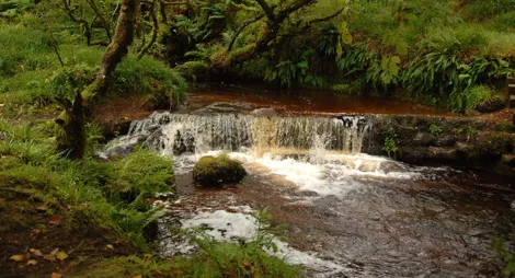
Follow Glenashdale Burn up to the startling rocky
Uneven gravel and earth surface, with some rough rocky and muddy sections. Several steep slopes and some steps. Includes a narrow gap, several bridges and a section along the road.

Allow 1 ½ hours
Start at the Glenashdale forest entrance in Whiting Bay, ¼ mile (0.5 km) from the Ashdale Bridge car parks.
A stiff climb to the remarkable prehistoric chambered cairns at Giants’ Graves, revealing wonderful views over Whiting Bay.
Long steep slope for 600m. Mostly firm gravel and earth surface. Some rough and potentially muddy sections with exposed tree roots. Includes some bridges and steps.

Allow 2 hours
People once believed that giants buried their victims here. Today we think these unusual horned chambered cairns were built by Stone Age people for ceremonies. You'll enjoy the same sensational views as they did over 5000 years ago.
Start at the Glenashdale forest entrance in Whiting Bay, ¼ mile (0.5 km) from Ashdale Bridge car park.
Climb through the forest above the stunning Eas Mor waterfall to reach an enchanting loch in the hills.
Uneven earth and rock surface, with several muddy sections. Long fairly steep slopes. Crosses one shallow ford and has low overhanging branches.

Allow 2 hours
Start from Eas Mor car park, at the junction of the A841 and the minor road to Kildonan, to the west of the village. It is maintained by volunteers from Eas Mor Ecology.
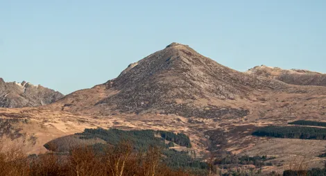
A fabulous forest cycle route with wildlife, waterfalls and views to Goatfell and Ireland.
Allow 2 hours
Stay on the forest roads or make a longer circular route by returning on The Ross, a minor public road between Lamlash and Kilmory. The route includes short detours to Glenashdale Falls, Meallach's Grave and other archaeological features as well as open views to Goatfell, Holy Isle and even Ireland on a clear day.
Start from Dyemill forest car park or the Aucheleffan forest entrance, one mile / 1.6 km east of Kilmory. You can also start or exit at Whiting Bay.
Working forest road with some steep climbs and loose surfaces. Minor public road with one steep climb. Mountain bikes are recommended for the forest section.
There are public toilets and places to eat in Whiting Bay. Kilmory village hall also has toilets.
There is no charge to park in this car park.
Travel by ferry from Ardrossan in North Ayrshire to Brodick and then follow the A841 south for 8 miles (12.8 km) to Whiting Bay. Leave your car in one of the council car parks at Ashdale Bridge, at the southern end of the village.
Cross the road to the Forestry Commission sign at the start of a narrow lane. The Glenashdale forest entrance is ¼ mile (0.5 km) along the lane at grid reference NS 042 252.
Alternatively, continue west on the A841 towards Kilmory for another 7½ miles (12 km). One mile (1.6 km) east of the village you'll see a blue sign for the Dyemill Cycle Route. Turn right here and continue on a dirt track for one mile (1.6 km). There's informal parking at the Aucheleffan forest entrance, grid reference NR 974 220.
KA27 8QX is the nearest postcode to the Glenashdale forest entrance.
KA27 8PH is the nearest postcode for the Aucheleffan forest entrance.
There are bus stops in Whiting Bay and Kilmory. You'll find timetable details at Traveline Scotland.
Have a question or suggestion for improvement?

Burnside trails, gentle waterfalls, and a climb to lonely Urie Loch

Start exploring Arran, with cairns, standing stones and lots of red squirrels

Explore the castle grounds and forests with views over Brodick Bay