Wednesday, 21 Jan 2026
Red Squirrel Appreciation Day falls on the 21 January this year and we're sharing some of our favour…
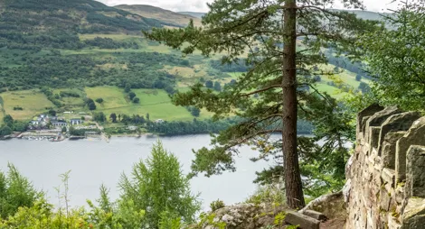
Relax above the shores of Loch Rannoch, or hike up the stunning gorge. Look out for stands of ancient Scots pine, and views over the nearby Black Wood of Rannoch.
Carie is a great place to watch for wildlife. As well as red squirrels, you might see deer and pine martens as you explore the woodland trails.
An interesting short trail through the Douglas firs, Norway spruce and oak trees along the busy Carie Burn.
Uneven gravel surface with some narrow, rocky and grassy sections. Includes some fairly steep slopes.

Allow ¼ hour
There's plenty to see and do on this short trail. Contrast the deciduous oaks, which lose their leaves in winter, with the upright evergreen spruces, the red squirrel's favourite seed source.
Head further up the Carie Burn on this charming circuit of the birch-shrouded campsite.
Uneven earth and grass paths with exposed tree roots. Some fairly steep slopes. Includes bridges 0.9m wide. Look out for traffic along the forest road.

Allow 1 hour
There have been trees here on Rannoch Moor since ancient times and there are still plenty of colourful native trees amongst the productive, fast-growing conifers. Enjoy the deep shade of oak woods, cross the cool, rushing burn and look up for golden eagles overhead as you cross open fields to complete your circuit.
Follow the Allt na Bogair gorge through woods rich with oak, birch and ancient Scots pine. There are great views across Loch Rannoch towards Ben Alder.
Mostly wide, firm but uneven gravel surface. Some grassy sections with exposed tree roots and muddy patches. Includes a number of steep slopes. Beware vehicles along the forest roads.

Allow 3 ½ hours
Hike up the gorge, high above the rushing waters, and look out for a stand of ancient Scots pine, with their reddish trunks and distinctive 'bunnet' shape, just before the trail turns away from the burn. There are stunning views over Loch Rannoch and the Black Wood of Rannoch on your return – on a clear day you can see Ben Alder and the toothy outline of the Glencoe mountains beyond Rannoch Moor.
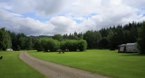
If you'd like to spend a little longer here, Kilvrecht Campsite next door offers basic camping and caravanning in a beautiful location from March to October.
There is a small shop in the nearby village of Kinloch Rannoch, 3 miles to the east. The towns of Pitlochry and Aberfeldy, both 20 miles away, offer a range of shops and places to eat and drink.
There is no charge to park in this car park.
Carie is about 3½ miles west of Kinloch Rannoch on the unclassified South Loch Rannoch road. When in Kinloch Rannoch, follow signs for 'South Loch Rannoch'. The entrance and car park for Carie is about ½ mile beyond Kilvrecht Campsite.
PH17 2QJ is the nearest postcode for Rannoch.
Have a question or suggestion for improvement?

Peaceful forest campsite above Loch Rannoch

Begin your ascent of Schiehallion

Views of Loch Tay and Glen Lyon from above Kenmore