Wednesday, 21 Jan 2026
Red Squirrel Appreciation Day falls on the 21 January this year and we're sharing some of our favour…
The Iron Age hillfort on top of Ord Hill was once an impressive sight. Its stout stone walls and wooden palisade would have clearly shown the strength and power of the people living there. This and the fort at Craig Phadrig must have at one time dominated the areas landscape. Today, the fort is a ruin, but the views over the Moray Firth are still just as good.
Ord Hill is a great place for wildlife. Look out for red squirrels and woodland birds in the trees here. You might even spot a bottlenose dolphin in the firth below.
Walk up through the rich, mossy forest to reach the jumbled rocks of the Iron Age fort on top of Ord Hill.
Uneven earth and gravel paths, with some narrow, rocky and muddy sections. Long fairly steep slopes and some steps.

Allow 1 hour
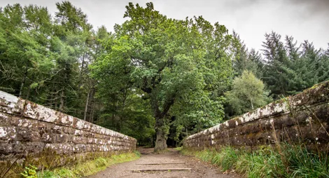
Climbing through the forest to the hill fort, there are lots of places to play hide and seek! The woodland is an attractive mix of different trees, with mosses and lichens decorating the branches and rocks.
A wonderful circuit of Ord Hill with spectacular views over Inverness and the Moray Firth.
Mostly wide, firm gravel surface. Long moderate slopes with some steeper sections. Section of uneven earth and gravel path with some steps and exposed tree roots up to viewpoint.

Allow 1 ½ hours
Watch for red squirrels as you circle the hill, and pause to admire the views over the Black Isle countryside and the Moray Firth. If you’re really lucky you might spot a dolphin!
Ord Hill has a permanent orienteering course that offers a great introduction to this fun and adventurous sport. Visit the British Orienteering website to find out how to download course maps.
There are toilets and places to eat in Inverness.
There is no charge to park in this car park.
Coming from Inverness, cross the Kessock Bridge northbound on the A9 and take the second exit, signposted for Kilmuir and Drumsmittal. Follow signs for Kilmuir and Drumsmittal through the roundabout, under the A9 and onto a single track road. After ¼ mile (400 metres) turn right at the signpost for Kilmuir. The car park entrance is signposted to the right off this road.
There is another car park, run by Highland Council, off the southbound carriageway of the A9 just north of the Kessock Bridge. Access to the forest from here is on steep, rough paths.
IV1 3ZG is the postcode for Kilmuir. Coming from the A9 you will pass the forest entrance on the way.
Have a question or suggestion for improvement?

Walk through history and visit the home of a Pictish king

Visit the well and make a wish in this gentle woodland

Folklore and history hidden among the trees