
Thursday, 05 Mar 2026
It’s Scottish Apprenticeship Week! Apprentices are an important part of our workforce - helping us …
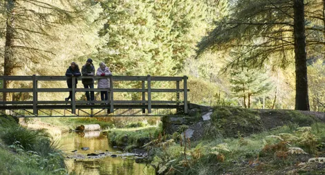
Bring your binoculars. The mixture of peaceful river, open moorland and forest backdrop make this car park a good vantage point for watching wildlife. You might even spot birds of prey.
It is also the starting point of a traditional cattle drove route. This folllows the peaceful Strathrory river down to the fertile meadows of Scotsburn. The route passes through wild heather moorland and peaceful oak and pine woods. Look out for roe deer, black grouse and a rich variety of birds and wildflowers in summer.
You'll find toilets, shops and places to eat in Alness or Tain.
This route is not waymarked and can be wet in places. Please take an OS or other suitable map with you if you walk this trail.
The route goes from one car park to another so you'll need to organise transport from the other end of the trail or be prepared to walk or cycle back to the start. The distance by road between the two ends is about 10 miles (16 km).
There is no charge to park in this car park.
From Inverness, head north on the A9 for 16 ¾ miles (26.8 km). After Evanton, turn left for the B9176 to Lairg and Bonar Bridge (the Struie road) and follow this for 7 ¾ miles (12.4 km). Continue uphill after Strathrory Bridge and you'll see the car park on your right at grid reference NH 667 778.
The drove route ends at Scotsburn near Invergordon. From Inverness follow the A9 north for 21 ¾ miles (33.6 km). At the Tomich / Invergordon junction, turn left and follow the singletrack road for 1 ½ miles (2.4 km), then turn right onto Scotsburn Road. After 3 ½ miles (5.6 km) you'll see a green Scottish Rights of Way sign on your left. There's a small area for parking at grid reference NH 733 763.
IV17 0XP is the nearest postcode, about 2 miles (3.2 km) before you reach the Strathrory car park from the south. IV18 0PE is the nearest postcode to Scotsburn, where the trail ends.
Have a question or suggestion for improvement?
Gentle strolls among the pines around Aldie Burn
Climb to Pulpit Rock for panoramic views across to Tarbet Nes
Towering pines and a bed of heather ten minutes from the beach
Thursday, 05 Mar 2026
It’s Scottish Apprenticeship Week! Apprentices are an important part of our workforce - helping us …

Wednesday, 25 Feb 2026
Guest blog by Beat Forester Sam Brown. There has been a lot going on in the glen over the past two y…

Wednesday, 21 Jan 2026
Red Squirrel Appreciation Day falls on the 21 January this year and we're sharing some of our favour…