Wednesday, 21 Jan 2026
Red Squirrel Appreciation Day falls on the 21 January this year and we're sharing some of our favour…
All downhill trails are now open except Make or Brake which is closed long term due to storm damage.
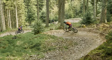
A 7stanes mountain bike centre, Innerleithen is renowned for its technical downhill trails, graded either red or extreme black. There's also some serious cross-country action on the challenging red-graded Innerleithen XC trail.
Innerleithen 7stanes route card (PDF)
Brilliant uplift service at Innerleithen Trails! More info at: www.adrenalinuplift.co.uk.
Phytophthora Ramorum, a disease that kills larch trees, has reached Innerleithen’s Traquair Forest. Please help slow the spread of the disease by making sure your bikes, shoes, kit, dogs, horses, buggies etc., are all clean before visiting Innerleithen and other forests. Thank you. #keepitclean
Grade – Red: Difficult ![]() Expect a mixture of steep climbs, descents and / or avoidable features. Larger jumps, berms and rollable features at controlled speed. Technical features such as tree roots, drop-offs and large rocks. Very variable surfaces.
Expect a mixture of steep climbs, descents and / or avoidable features. Larger jumps, berms and rollable features at controlled speed. Technical features such as tree roots, drop-offs and large rocks. Very variable surfaces.
Not for the faint hearted, this route includes a leg-burning climb, some thrilling singletrack descents and optional black graded features. You’re on single track right out of the car park, with a switchback climb through the forest and a lung-busting climb to the summit of Minch Moor ahead of you. It’s back to singletrack on the way down, with jumps, drop-offs and optional black-grade features.
Grade – Double-black: Extreme ![]() Expect a very fast and steep descents. Large drop-offs, jumps and unavoidable obstacles that require high levels of skill and commitment. Extreme level of exposure or risk. Rapid rate of surface change.
Expect a very fast and steep descents. Large drop-offs, jumps and unavoidable obstacles that require high levels of skill and commitment. Extreme level of exposure or risk. Rapid rate of surface change.
Some of the best downhill routes in the country. The mix of 'natural' and machine-built routes drops steeply through the forest from the summit of Plora Rig. All routes are graded 'extreme', with small, medium and large features. Full face helmet, gloves, body armour and a downhill specific bike are strongly recommended for all trails. The four waymarked downhill tracks are:
More than just mountain bike trails, you’ll also find safe places to enjoy the forest. We recommend the section of The Southern Upland Way, which passes through Traquair village and heads up on to Minch Moor.
The trails and facilities in Innerleithen make it a popular destination for mountain bikers, but there are plenty of other paths that cater for a quieter time in the forest. Find out more about how we’re working to create ideal environments for walking, mountain biking and horse riding in the Tweed Valley Forest Park.
The nearest public toilets and places to eat are in Innerleithen.
The charges to park at Innerleithen are:
Blue Badge holders park free. Please display your Blue Badge clearly.
Payment can be made using coins, card or RingGo.
Annual parking passes are available for this site, visit our parking page for more information.
Please park with care and consideration. In particular please park in designated parking areas only and do not block entrances or gates. Nearby car parks with free parking can be found in our Forest Search.
Our Stay the Night scheme now runs right through the year. This means self-contained motorhomes and campervans will be able to park overnight for one night in some of our car parks.
There is a £10 charge to Stay the Night at this car park. Payment can be made through RingGo with details of how to do this at each car park.
To help plan your stay, please see the details below:
Please visit our Stay the Night page for full details, participating locations, best practice, and terms and conditions of use.
Maximise your time on the trails with Adrenalin Uplift. When available, this shuttlebus service runs every 15 minutes, carrying up to 64 riders and their bikes to the top of the hill.
Visit Adrenalin Uplift to book day, weekend and season passes.
From the main road through Innerleithen village, look for the road sign for '7stanes Trails' next to St James' Church. The car park is ½ mile along this road on the left.
EH44 6PW is the nearest postcode, a little to the south-west.
Innerleithen village is well-served by buses. It's a ½ mile walk to the forest from the nearest bus stop. Plan your journey at Traveline Scotland.
Have a question or suggestion for improvement?

A forested climb to the site of an Iron Age hill fort

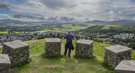
Beautiful views of Tweed Valley and 2000 years of history

Award-winning mountain biking and so much more