Wednesday, 25 Feb 2026
Guest blog by Beat Forester Sam Brown. There has been a lot going on in the glen over the past two y…
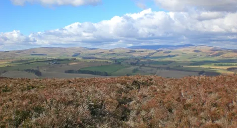
Wauchope Forest has trails great for exploring, cycling and horse riding. Here you’ll find a babbling burn and a mixed woodland. Keep an eye out,you might spot red squirrels in the canopy and goshawks overhead. Others take you up to open ground with panoramic views of the border country and the Cheviot Hills.
The course of the Hyndlee Burn was changed when a new forest road was built here. The burn is now carefully managed to make it as natural as possible and attractive to wildlife. Stop and look at the water near the Wauchope car park. Do you seehow the logs have been placed in the water to create still pools, which attract fish, insects and birds. The forest is also planted with plenty of clearings to help rare and threatened wildlife feel at home. Black grouse, goshawk, and juniper are priority species in this area.
Walk in the footsteps of Jonny the forester, along the Catlee Burn and up through oak, ash, birch and larch.
Largely wide firm gravel track, with section of uneven earth and stone. Long slope with steep sections. Several bridges.

Allow ¾ hour
Climb up through the spruce to enjoy the solitude of Wauchope, before winding back down through the trees. A good leg stretch.
Mostly wide, firm gravel tracks with long moderate slopes. Includes section of narrow, uneven earth and rocky paths with short fairly steep slopes.

Allow 1 hour
Wauchope is a lovely place for a picnic, with picnic tables at most of the car parks.
You’ll find a selection of places to shop, eat and drink in Hawick and Newcastleton. There are also public toilets in Hawick.
Parking is free in this car park during the day.
Please note, overnight parking is not permitted unless part of our Stay the Night scheme – see below.
Our Stay the Night scheme now runs right through the year. This means self-contained motorhomes and campervans will be able to park overnight for one night in some of our car parks.
There is a £10 charge to Stay the Night at this car park. Payment can be made through RingGo with details of how to do this at each car park.
To help plan your stay, please see the details below:
Please visit our Stay the Night page for full details, participating locations, best practice, and terms and conditions of use.
Wauchope lies either side of the B6357, which links Bonchester Bridge and Newcastleton in the Scottish Borders.
From Hawick, head to Bonchester Bridge on the A6088. Turn right on to the B6357 south towards Newcastleton for approximately two miles. Hells Hole is the first access point to Wauchope and is on the right-hand side.
TD9 9TB is the nearest postcode.
Have a question or suggestion for improvement?

Wild hills in the border country

Thrills galore in the rolling forest - brilliant for biking

A stunning woodland landscape with tranquil trails