Wednesday, 21 Jan 2026
Red Squirrel Appreciation Day falls on the 21 January this year and we're sharing some of our favour…
The Cross-Border Route loop is closed, due to a collapsed road along Kershope Burn. Please use the northern stretch of the Cross-Border Route. The southern stretch is closed.
The Red Mountain Bike Route and Purple Hanging Tree Walking Trail both have a diversion in place, due to windblown trees.
Whether you’re planning a picnic with lovely views, a ramble in the forest or looking to try out some mountain bike tracks, Newcastleton is the perfect setting. The forest is also a wildlife haven.Don’t miss the hide overlooking Priest Hill and the stunning Liddel valley. There are traces of ages past here too - look out for ancient settlements and burial cairns as you go.
The forest stretches to the English boarder, where it meets Kielder Forest. This makes it part of the largest forest in Britain. It’s also a powerhouse for timber production and wildlife who call it home. You’ll also find remnants of its earlier history when the hills were dotted with ancient settlements.
During spring/summer 2024, we consulted with many stakeholders (local people, FLS staff, visitors and organisations) on the future for the recreation offering in and around Newcastleton Forest. We listened and learned from everyone and are delighted to publish the final draft document.
The Ponds Trail is open with one bridge on the trail currently closed for repairs. Access to ponds on either side of the bridge is still possible.
A charming stroll around the restful ponds on Whithaugh Burn. Sit by the water and look for wild flowers and dragonflies among the hazel and willow trees.
Firm gravel surface with occasional loose stones. Short fairly steep ramps, but plenty of seats along the route. Two bridges 0.9m wide.

Allow ¼ hours
The ponds are a great draw for wildlife – look out for ducklings in spring and glittering dragonflies dashing across the water in summer.
Great views across Liddesdale from the trig point on Priest Hill. Look for an Iron Age earthwork and a wildlife hide.
Uneven grassy paths. Long slope to summit with fairly steep sections. Some patches may be muddy.

Allow 1 ½ hours
This trail leads you up through spruce trees to reach the open summit of Priest Hill. There are panoramic views from here of rolling Liddesdale and beyond. You’ll also see the Liddel Water, which at some points forms the border between Scotland and England. Visit the wildlife hide close to the trail and linger a while to see what wildlife passes by. You might also like to return to the hide on a summer’s evening to see the local badger clan emerge.
A section of the trail is closed between Pouterlampert and the car park, due to multiple windblown trees. Please walk the trail clockwise from Priest Hill car park and follow the diversion back to the car park after Pouterlampert.
Discover the wild history of Newcastleton. Follow an old drove road to Bellshiel, and visit the Hanging Tree and ruins of Pouterlampert.
Rough grass and earth paths with numerous muddy sections. Several short steep slopes. Includes two bridges.

Allow 1 ½ hours
This trail begins along the historic drove road past the settlement of Belshiel, then returns through an atmospheric area of old, well established woodland. Pass the 500 year old farm of Pouterlampert and take a short detour to see the Hanging Tree and imagine what stories this veteran ash tree could tell.
Take the full circuit around Priest Hill, down to the banks of Liddel Water. Ever-changing views over the valley and Border hills.
Rough grassy path with some fairly steep slopes. Muddy sections and a shallow ford.

Allow 2 hours

Newcastleton is one of the internationally-renowned 7stanes mountain biking trail centres.
Phytophthora Ramorum, a disease that kills larch trees, has reached Newcastleton. Please help slow the spread of the disease by making sure your bikes, shoes, kit, dogs, horses, buggies etc., are all clean before visiting Newcastleton and other forests. Thank you. #keepitclean
Grade – Blue: Moderate ![]()
Expect a mixture of climbs and descents with moderate gradients, technical features like tree roots and rock steps; jumps and berms. Rollable features at controlled speed. Variable surfaces.
Fun singletrack for all the family. Perfect for beginners or families, this route offers a gentle introduction to mountain biking complete with stunning views, forest paths and some fun descents.
Grade – Red: Difficult ![]() Expect a mixture of steep climbs, descents and / or avoidable features. Larger jumps, berms and rollable features at controlled speed. Technical features such as tree roots, drop-offs and large rocks. Very variable surfaces.
Expect a mixture of steep climbs, descents and / or avoidable features. Larger jumps, berms and rollable features at controlled speed. Technical features such as tree roots, drop-offs and large rocks. Very variable surfaces.
Feel the power of this fast and furious route. Fast and narrow singletrack guides you through the forest and around this adrenaline pumping route. There are plenty of special features to keep you on your toes and climbs to test your cardio fitness.
This 17½ mile (28 km) expedition from Scotland to England and back is ideal for well-prepared visitors, cyclists and horse-riders
Waymarkers with purple arrows will take you round the trail. Where you’ll visitthe stunning Kershope Burn and the Three Counties meeting point. This is where the Scottish Borders, Northumberland and Cumbria join together. Look out for the historic Bloody Bush toll stone, which marks the crossing between Scotland and England, as well as the 21st century Border Stane. On a clear day there are superb views of the rolling borderlands.
Please note – the trail on the Scotland side is waymarked in one direction only - anti clockwise.
You should allow 9 hours to walk the route. Check our advice on hill walking before you set off.
Public toilets and showers are available in Newcastleton village just off Douglas Square on Langholm Street next to the Fire Station (charges apply). Newcastleton also has several places to eat, drink and shop.
There is no charge to park in this car park.
Newcastleton lies on the B6357, which links Bonchester Bridge and Canonbie.
For walking trails, take the unclassified road at the southern end of Newcastleton village to Priest Hill Car Park approx 2.0 miles (3.2km) from the village.
The 7stanes mountain bike trails all start/finish at the Douglas Square trailhead in the centre of Newcastleton Village.
TD9 0TA is the nearest postcode for Priest Hill car park in Newcastleton Forest. For the 7stanes trailhead in the village, use postcode TD9 0QD.
There are regular buses to Newcastleton from Hawick and Carlisle (except Sundays). You’ll find details at Traveline Scotland.
You can also reach Newcastleton under your own steam on the Reivers Route coast-to-coast cycle trail.
Have a question or suggestion for improvement?

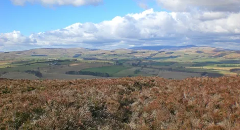
Wild hills in the border country

A woodland full of wildlife, with a picturesque burn

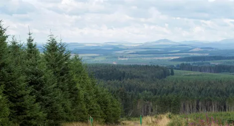
A stunning woodland landscape with tranquil trails