Wednesday, 21 Jan 2026
Red Squirrel Appreciation Day falls on the 21 January this year and we're sharing some of our favour…
Forest Operations:
Timber haulage is taking place at Green Hill. Please do not approach or pass machinery unless operator has seen and acknowledged you.
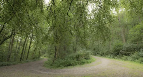
Ae Forest is the perfect place to visit, whether you want to relax with a picnic beside the river, watch woodland wildlife, stroll through the trees or burn off some serious energy on horseback or on the superb mountain bike trails.
The waymarked routes include gentle rambles beside the sparkling Water of Ae as well as longer hikes into the hills with wonderful views. Ae Forest covers an area about the size of 10,000 football pitches. Huge numbers of trees are harvested each year for timber, which is used for everything from paper to house building, and thousands of new trees are planted too. There’s a long history of forestry here: Ae village was built by the Forestry Commission in 1947 to house forest workers.
A peaceful, short stroll along the waters of Ae, with a perfect opportunity for a picnic.
Wide and firm track throughout with gentle rises and occasional loose gravel.

Allow ½ hour
Watch for wildlife in the trees!
A delightful wander along the restful Water of Ae. As the path weaves beneath soaring Norway spruce trees, watch for wildlife in the trees and burn.
Firm gravel surface throughout. Some loose stones and a couple of short fairly steep ramps. Two cattle grids and one wide bridge. Look out for vehicles on the first section.

Allow 1 ½ hours
Look for red squirrels in the canopy, and dippers or statuesque herons along the burn. Take advantage of the pretty picnic sites beside the Water of Ae or just cool your feet in its sparkling shallows.
A long route along the Water of Ae before climbing the hill. Great views from the top, across to Queensberry Hill and Harestanes Wind Farm.
Long slopes with steep sections on rough, narrow earthy path with exposed tree roots and muddy patches. One section of steps. Watch for vehicles on the first section.

Allow 3 ½ hours
Craigshields View is one of the best views in the area, taking in rolling farmland and out past Dumfries to the Solway Estuary in the far distance.
There’s also a bike shop/hire on site as well as bike uplift.
Forest of Ae 7stanes route card (PDF)
Grade - Green: Easy ![]()
Expect relatively flat, wide, and smooth trails. Gentle climbs, descents, rollers and berms, with easy to avoid features such as rocks and potholes. Surface might be loose, uneven or muddy at times.
A great place to try out mountain biking for the first time, and perfect for families, this trail takes you to a beautiful viewpoint overlooking the Water of Ae. There are sections of easy singletrack and forest road and only one brief sharp climb. You’ll be rewarded with lovely views over the Water of Ae.
The trail is closed between Post 45 and Post 44. Please follow the diversion along the forest road before re-joining the trail at Craigshiels.
Grade – Blue: Moderate ![]()
Expect a mixture of climbs and descents with moderate gradients, technical features like tree roots and rock steps; jumps and berms. Rollable features at controlled speed. Variable surfaces.
Suitable for those families looking to take in a little bit more of the forest. Delve a little deeper into the forest, on this moderate route consisting of forest road and singletrack. Enjoy good views of the Water of Ae coupled with a fun ride.
The trail is closed between Post 45 and Post 44. Please follow the diversion along the forest road before re-joining the trail at Craigshiels.
Grade – Red: Difficult ![]() Expect a mixture of steep climbs, descents and / or avoidable features. Larger jumps, berms and rollable features at controlled speed. Technical features such as tree roots, drop-offs and large rocks. Very variable surfaces.
Expect a mixture of steep climbs, descents and / or avoidable features. Larger jumps, berms and rollable features at controlled speed. Technical features such as tree roots, drop-offs and large rocks. Very variable surfaces.
A rocky ride through the countryside. The highlight of the route is the final descent with its multiplicity of jumps. This cross-country trail is peppered with jumps, drop-offs and tabletops that are sure to put a smile on your face. Take the trail slowly if you want a gentler ride, or the more experience mountain biker can tackle some of the big air possibilities.
Grade – Red: Difficult ![]() Expect a mixture of steep climbs, descents and / or avoidable features. Larger jumps, berms and rollable features at controlled speed. Technical features such as tree roots, drop-offs and large rocks. Very variable surfaces.
Expect a mixture of steep climbs, descents and / or avoidable features. Larger jumps, berms and rollable features at controlled speed. Technical features such as tree roots, drop-offs and large rocks. Very variable surfaces.
A downhill run that’s a great ice breaker for newcomers to this discipline of mountain biking. A downhill run packed with technical features. Each obstacle on The Shredder has an easier alternative so you can choose the best option for you based on your own mountain biking experience.
The Shredder is currently closed due to Storm Eowyn.
Grade – Double-black: Extreme ![]() Expect a very fast and steep descents. Large drop-offs, jumps and unavoidable obstacles that require high levels of skill and commitment. Extreme level of exposure or risk. Rapid rate of surface change.
Expect a very fast and steep descents. Large drop-offs, jumps and unavoidable obstacles that require high levels of skill and commitment. Extreme level of exposure or risk. Rapid rate of surface change.
A downhill challenge with seriously gnarly rocky sections and exhilarating drop-offs to satisfy the most demanding of riders. A steep and rocky start is followed by a highly testing off-camber descent on this trail designed to challenge even the most seasoned biker.
The trails at Ae are ideal for horse riding. There’s plenty of room for horse boxes at the Naze car park, and you can start the British Horse Society Countryside Trail from here.
You’ll find delicious refreshments at the Ae café on site.
Assistance dogs are welcome in the café. For our other canine visitors, there’s water available outside. The café has outdoor seating as well.
The charges to park at Forest of Ae are:
Blue Badge holders park free. Please display your Blue Badge clearly.
Payment can be made using coins, card or RingGo.
Annual parking passes are available for this site, visit our parking page for more information.
Please park with care and consideration. In particular please park in designated parking areas only and do not block entrances or gates. Nearby car parks with free parking can be found in our Forest Search.
Our Stay the Night scheme now runs right through the year. This means self-contained motorhomes and campervans will be able to park overnight at the Naze car park.
There is a £10 charge to Stay the Night at this car park. Payment can be made through RingGo with details of how to do this at the car park.
To help plan your stay, please see the details below:
Please visit our Stay the Night page for full details, participating locations, best practice, and terms and conditions of use .
Turn off the A701 at Ae Bridgend, following signs to Forest of Ae. You’ll reach Ae village after about 2 miles (3km). Turn right at the Forest of Ae sign at the crossroads just beyond the village, then follow signs to the car park.
The mountain bike trails start at the Naze car park. To get there, go past the entrance to the main car park and continue along the road for about ½ mile (1km). Take the next left, signposted for 'Ae Valley car park'. There’s also parking for horse boxes here.
DG1 1QB is the nearest postcode.
The nearest station is at Dumfries. There are regular buses between Dumfries and Moffat, stopping at Ae Bridgend and Parkgate, both about 2 miles (3 km) from Ae village. Check Traveline Scotland for details.
Have a question or suggestion for improvement?

Quiet woodland walks next door to Dumfries

Follow overgrown railway tracks through a wild wood

Escape from it all in a forest buzzing with nature