Wednesday, 21 Jan 2026
Red Squirrel Appreciation Day falls on the 21 January this year and we're sharing some of our favour…
Toilet Block Update - 1 November 2025
The toilet block has been damaged by a fallen tree and is currently out of service. Portable toilets are available nearby. We apologise for any inconvenience.
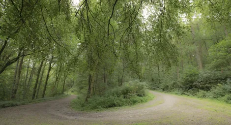
There’s something here for everyone. Open space to play, picnic and barbecue. Lots of trails with spectacular views and plenty of opportunities for wildlife watching.
Mabie’s woods and hills are peaceful today, but there’s plenty of evidence of industry here, if you know where to look. The Romans made charcoal and smelted iron in these hills. While forestry has always been important in this area. The Forestry Commission bought Mabie in 1943. This was part of a major wartime tree-planting scheme to rebuild timber reserves.
The forest is also home to a 7stanes mountain biking centre which caters for beginners right through to the most expert of riders.
A beautiful stroll beneath the redwoods and giant sequoia along the burn to reach the tranquil sensory garden and wildlife sculptures in Garden Wood.
Wide, firm surface throughout. Includes a number of short moderate slopes.

Allow ¼ hour
Stimulate your senses with furry leaves, trickling water, and chocolate-scented flowers in the sensory garden and look out for wooden wildlife sculptures and a poetry trail along the way.
A picturesque circuit of Chinney Field, which is filled with wild flowers in the summer and has good views across the Nith Estuary.
Wide, firm gravel surface throughout with some loose stones. Long moderate slopes with short steeper sections. One bridge.

Allow ¾ hour
Play poohsticks from the bridge as you cross the Mabie Burn and then visit the old sawmill below the field, which was once used to process timber from Mabie Forest. The area around the Old Sawmill is also a lovely spot for a picnic or barbecue.
Take a wander through the Stately Douglas Firs to find the relaxing tranquil Dalshinnie Loch.
Wide, firm gravel surface with some uneven loose sections and exposed tree roots. Moderate slopes with some steep sections.

Allow 1 ¼ hours
This trail climbs up through the woods to Dalshinnie Loch, perfect for picnics and dragonfly-spotting. Nightjars also hunt and nest in the scrub here.
Explore this quiet larch and beech dominated part of the forest for ever-changing views over the Nith Estuary and the rolling Galloway hills.
Mostly wide, firm gravel surface with some uneven sections and exposed tree roots. One short rough rocky section. Includes some steep slopes and a number of short flights of steps.

Allow 3 ½ hours
This trail climbs up through the woods to join a level forest road that circles the wooded flanks of Larch Hill. From this high vantage point you can enjoy ever-changing views over Mabie Forest, including the Nith valley and Dumfries and out towards the Solway coast. On a clear day you may even glimpse England’s Lake District. On the way, look across the valley to spot the Goldielea Viaduct, which used to carry trains between Dumfries and Stranraer.
A wonderfully varied exploration of Dalshinnie Loch nature reserve and the two hills above. There are extensive views of Criffel and the Solway Firth from both Marthrown and Craigbill Hills.
Mostly gravel surface. Short sections of rough earth and stone with muddy patches. Long steep slopes for up to 500m. Includes some steps and a 0.9m opening.

Allow 3 ½ hours
This trail climbs up through the woods to Dalshinnie Loch, perfect for picnics and dragonfly-spotting. Nightjars also hunt and nest in the scrub here. Keep climbing to a panoramic viewpoint overlooking the glittering Solway estuary, then wind through Mabie Nature Reserve - there’s a host of butterflies here in summer. Watch out for ospreys fishing on Lochaber Loch as you pass above it.

Mabie is one of the world class 7stanes mountain bike venues. It features a superb variety of green, blue and red graded trails, an extreme downhill section for the serious experts, and a skills area for honing your technique.
Grade - Green: Easy ![]()
Expect relatively flat, wide, and smooth trails. Gentle climbs, descents, rollers and berms, with easy to avoid features such as rocks and potholes. Surface might be loose, uneven or muddy at times. Find out more about the grading system.
Gentle slopes and sweeping scenery give you an easy enjoyable ride. Gentle slopes and sweeping scenery give you an easy enjoyable ride. Big Views by name, big views by nature - this trail offers excellent views of the Solway Firth and Nith estuary. You’ll mainly find forest road on this route and the gradients are manageable, ensuring a pleasant ride.
Grade – Blue: Moderate ![]()
Expect relatively flat, wide, and smooth trails. Gentle climbs, descents, rollers and berms, with easy to avoid features such as rocks and potholes. Surface might be loose, uneven or muddy at times.
The Viewpoint Loop has more technical single track, as it shares a short section of the red route making it ideal for those wishing to advance to red grade trails. The trail returns on the green route. The views from the forest road overlooking Dumfries and the Solway Firth are spectacular, and perfect for stopping to take a break. Look out for the telescope on route to take a closer look.
Grade – Blue: Moderate ![]()
Expect a mixture of climbs and descents with moderate gradients, technical features like tree roots and rock steps; jumps and berms. Rollable features at controlled speed. Variable surfaces.
The Woodhead Loop is slightly harder than the Big Views Loop and explores the far side of the forest using quiet forest roads and some easy singletrack. This route is the perfect option for novices looking to build their confidence.
Grade – Red: Difficult ![]() Expect a mixture of steep climbs, descents and / or avoidable features. Larger jumps, berms and rollable features at controlled speed. Technical features such as tree roots, drop-offs and large rocks. Very variable surfaces.
Expect a mixture of steep climbs, descents and / or avoidable features. Larger jumps, berms and rollable features at controlled speed. Technical features such as tree roots, drop-offs and large rocks. Very variable surfaces.
A mixed cross-country route in stunning woodland on natural trails and singletrack. A fast, challenging ride in places with rocky obstacles and tight berms. The Phoenix Trail takes you cross country through majestic woodland on both natural trails and singletrack.
There’s an adventure playground nestling amongst the trees next to the car park. This issafe and fun for the kids and a picturesque spot for a picnic.
Mabie Forest is home to red squirrels, badgers, roe deer, foxes and bats. We manage an area near Dalshinnie Loch to encourage the elusive nightjar. We’re doing that by creating open areas amongst the scrubby birch trees where it can nest and hunt.
Many species of insects, butterflies and moths also live here. In fact, over 20 of Scotland's 32 resident butterflies, including the scarce pearl-bordered fritillary have been spotted in this forest. Dead trees are left standing in the forest to provide a home for insects and their larvae, which in turn provide food for woodpeckers and bats. Take the Lochaber Trail to find out more about butterflies and see how many you can spot.
There’s a hide on the edge of Lochaber Loch, here you can watch for birds such as mute swan and great crested grebe. You might also be lucky enough to spot ospreys fishing on the loch in summer.
There are toilets, including accessible facilities, near the main car park.
There are refreshments available at Mabie House Hotel.
There are also public toilets and plenty of places to eat, drink and shop at nearby Dumfries.
The charges to park at Mabie are:
Blue Badge holders park free. Please display your Blue Badge clearly.
Payment can be made using coins, card or RingGo.
Annual parking passes are available for this site, visit our parking page for more information.
Nearby car parks with free parking can be found in our Forest Search.
Mabie Forest lies just beside the A710 between Dumfries and New Abbey. Look out for signposts to the forest from the A710 about 4 miles (6.5 km) from Dumfries. Turn into the forest and it’s about ½ mile (1km) to the car park, at grid reference NX 950 709.
Please note that 'Mabie Farm Park' is signposted just before the entrance to the forest, but there is no vehicle access to the forest from the farm park.
DG2 8HB is the nearest postcode.
The nearest railway station is at Dumfries. There are regular buses between Dumfries and Sandyhills that stop near the entrance to the forest. You’ll find details at Traveline Scotland.
Have a question or suggestion for improvement?

Follow overgrown railway tracks through a wild wood

Quiet woodland walks next door to Dumfries

A mountain biking classic with gorgeous lochside trails