Wednesday, 21 Jan 2026
Red Squirrel Appreciation Day falls on the 21 January this year and we're sharing some of our favour…
Glentress is rightly celebrated for some of the best mountain bike trails in the country, but that's just the beginning of the story.
Head out on the trails, go on treetop adventure or enjoy magnificent views of the Tweed Valley.
Take some time to learn more about other wildlife you may encounter in the Wildlife Hub. here you can watch an observation beehive and view live osprey cams.


The Glentress Masterplan is a strategy to deliver a sustainable future for the forest and aims to deliver a world class visitor experience. It will create new recreation opportunities and holiday accommodation which will benefit the local community, visitors from around the world, local businesses, and support regional tourism.
While works progress at Glentress, we ask all visitors to take care, follow all safety signage, and follow instructions from staff and contractors around the forest.
All trails are accessed by following the shared, Multi-user Trail first.
The Multi-user Trail is marked with a brown line on the map and trail distances below include this Multi-user Trail section.
All trails cross or include forest roads, look out for vehicles and other users.
Glentress walking trail route card (PDF)
Discover great views over the Tweed Valley on this accessible path around Glentress. The Multi-user Trail connects the Glentress Gateway to the café, bike shop, skills area, taster trails and the start of all walking and mountain biking routes.
Wide, firm gravel path with gentle slopes and various resting points. One section of minor road crossing with a fairly steep side slope. Moderate slope for access between Gateway and café/bike shop.

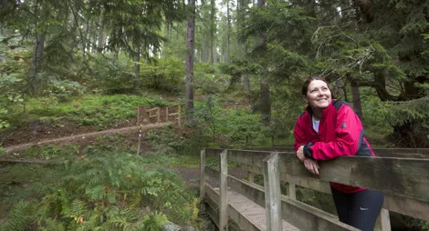
Stroll around the enchanted Glentress ponds, an oasis of ash, birch and pine that is home to herons, bats and red squirrels.
Firm gravel path with regular seats. Short moderate ramps with some loose stones.

Allow 1 hour
The ponds lie in a hollow where a grove of Douglas fir once stood. Some of the trees came down in a storm some 40 years ago, and the ponds are now a peaceful, sheltered corner of the forest.
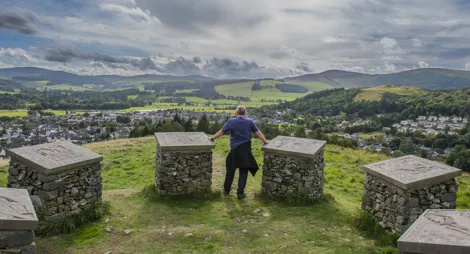
Get a glimpse of our Iron Age past on this delightful high level promenade above the Tweed Valley, with spectacular views over Peebles to the Caddon Hills.
Mostly firm gravel surface. Some sections of uneven earth and grass with exposed tree roots. Long moderate slopes with some steeper sections.
Please note, when accessed from Glentress Gateway, you should allow for an extra 3 hours to complete this trail.

Allow 1½ hours from Buzzard’s Nest
Visit the fortified settlements at Janet's Brae. Stop to imagine how our ancestors would have lived in this area over 2000 years ago on. this is a fascinating route through a beautiful and varied area of the forest.
Discover the charms of Glentress Burn, passing its serene ponds before winding through the magnificent Douglas firs above.
Numerous short steep slopes with some loose gravel. Some narrow and uneven earth sections with exposed tree roots and some narrow openings.

Allow 1 ½ hours
The Douglas fir trees on ‘Dougie Bank’, just above the ponds, are nearly 100 years old. Some of the trees from this part of the forest now sail the high seas as masts on tall ships. Douglas fir from Glentress has also been used to build the café and toilet block at Glentress Peel.
Explore the varied plantations of Glentress Forest, including characterful areas of Scots pine, Douglas fir and Norway spruce, and good views across the valley from the slopes of Cardie Hill.
Firm gravel and earth surface with loose and uneven sections. Long steep slopes for 400m. Includes some narrow openings and steps.

Allow 3 hours
Along the way you’ll find stories about the foresters who’ve built Glentress, including the ‘Lumberjills’ – women who worked here during World War II.
Climb to the top of Glentress Forest and pass the Iron Age settlement at Shieldgreen Tower. Magnificent views over Peebles and Soonhope Burn.
Rough earth and grass paths, often narrow. Several long and continuous steep slopes for over 500m. Some short muddy sections.
Please note, when accessed from Glentress Gateway, you should allow for an extra 3 hours to complete this trail.

Allow 6 hours from Buzzard's Nest
This trail takes you through remoter, mature woodland to some fine viewpoints to the north. You’ll often see buzzards and roe deer along the way.
Glentress is one of the world class 7stanes mountain bike venues. It features a wide range of trails for beginners and experts alike.
Glentress 7stanes route card (PDF)
If you’d like to get involved in the mountain biking community, check out the Glentress Trailfairies.
All network trails are accessed by following the shared Multi-user Trail first, which is marked with a brown line on the map.
Grade - Green: Easy ![]()
Expect relatively flat, wide, and smooth trails. Gentle climbs, descents, rollers and berms, with easy to avoid features such as rocks and potholes. Surface might be loose, uneven or muddy at times.
An excellent introduction to mountain biking. The route heads out on the Multi-user Trail into the forest before passing through some of Glentress’s oldest, tallest and most magnificent trees. After The Admiral, return to the Glentress Gateway on the Multi-user Trail then Apple Peel to finish.
Grade – Blue: Moderate ![]()
Expect a mixture of climbs and descents with moderate gradients, technical features like tree roots and rock steps; jumps and berms. Rollable features at controlled speed. Variable surfaces.
The Blue Route is big fun for all – from novices taking the next step up from green routes to experienced riders. This route can be split into various loops.
Start at the trailhead at Glentress Gateway and climb as far as the Buzzard’s Nest. Then either descend the bottom loop or continue to include the upper loop too. So many highlights, including Berm Baby Berm, Blue Velvet and Good Game. Add on the new descents – Harry’s Blue and Turn and Burn – for a thrilling flow trail finish. If you’ve got a mixed ability party, this is a great choice for the whole team.
Grade – Red: Difficult ![]() Expect a mixture of steep climbs, descents and / or avoidable features. Larger jumps, berms and rollable features at controlled speed. Technical features such as tree roots, drop-offs and large rocks. Very variable surfaces.
Expect a mixture of steep climbs, descents and / or avoidable features. Larger jumps, berms and rollable features at controlled speed. Technical features such as tree roots, drop-offs and large rocks. Very variable surfaces.
This world famous route is for experienced riders and it's sure to put a huge grin on your face. It has everything - big climbs, fabulous views, fast flowing descents and a fantastic blend of trail styles.
There are various options to finish: choose The Pie Run (shortcut) or Matrix and Lombard Street for the classic, more natural feeling Red Route return via Magic Mushroom and Falla Brae. Or choose Twitcher and Smells Like Tweed Spirit for an incredible bike park style flow trail finale.
Check out this video to see what you can expect from our newest red trail, Twitcher.
The Red Route is mostly open with some diversions:
Grade – Black: Severe ![]()
Expect a long and steep climbs, descents, and jumps. Numerous hazards including drop-offs and severe features. Rapid rate of surface change. Commitment required.
A long, technical ride for expert riders that takes you into the wilds of Glentress with epic climbs and thrilling descents. Return via the more natural Double X, Head Over Heels and Wormhole trails to link up with the end of the classic Red Route or via Twitcher and Castle Black for a thrilling, full on bike park style flow trail finish.
The Black Route is part open with some closures/diversions:
Develop your skills on our Taster Trails before heading out on the main mountain bike routes. There are Blue (Moderate) Red (Difficult) and Black (Severe) graded Taster Trails. You can find them at the far end of the Multi-user Trail loop, to the east of the Gateway building.
Boasting some of the longest and highest zip wires in Scotland, Go Ape Glentress is in a league of its own. Treetop Challenge is a 2-3 hour experience and is a great outdoor activity for friends and older families alike. Scramble up rope ladders, tackle tree top obstacles and fly down super-speedy ziplines.
Since the 1990s, ospreys have been coming to the Tweed Valley to breed. The Tweed Valley Osprey Project works to make sure they’re protected and can find good places to nest. In the Glentress Wildlife Hub you can learn more about these fascinating raptors. Follow the project's Facebook page at: www.facebook.com/tweedvalleyospreyproject
Each summerwe’re kindly loaned a colony of Scottish black bees by a keeper in the local area. During this time, you can visit them and learn more about bees at the Glentress Wildlife Hub.
Phytophthora Ramorum, a disease that kills larch trees. Please help us slow the spread of the disease by cleaning your bikes, shoes, kit, dogs, horses, buggies etc., before visiting any forest in the are. Our bikewash in the main car park is £1. It takes
The Glentress Forest Café is open daily 10:00 am to 4:00 pm (kitchen closes at 3:30pm).
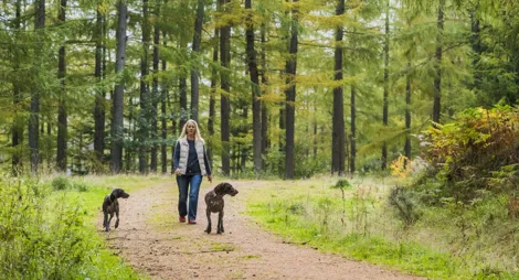
Dogs are welcome in the visitor centre and café. There's water and sheltered tie-up points outside the café.
An Automatic Number Plate Recognition (ANPR) car parking system is now in place at Glentress.
When you enter our car park, the camera will read your vehicle registration number and the entry barrier will raise to let you through.
The charges to park at Glentress are:
The first 30 minutes of parking are free – and the exit barrier will raise automatically for you if you have stayed for less than 30 minutes.
If you are an annual parking pass holder, the exit barriers will raise automatically for you.
If you have stayed longer than 30 minutes, and are not an annual parking pass holder, please pay by card before you leave at any of the pay machines located in the car parks and outside the Gateway building. Please leave within 20 minutes of paying.
If the exit barrier does not raise, please press the ‘help’ button and someone will assist you.
Blue Badge holders park for free. You can either:
Glentress Blue Badge registration form
Annual parking passes are available for this site via the onsite parking machines. For other ways to purchase, please visit our parking page.
The turn-off for Glentress is well signposted on the north side of the A72 between Peebles and Innerleithen.
EH45 8NB is the nearest postcode.
Have a question or suggestion for improvement?

Beautiful views of Tweed Valley and 2000 years of history

Climb through rolling hillside forest for glorious valley views

A forested climb to the site of an Iron Age hill fort