Neolithic art at Ormaig
Neolithic art at Ormaig
Illustration, photography and modern laser scanning techniques are helping us keep an accurate record of all significant historic assets on the land we manage.
Good visual records aid conservation and help us understand more about ancient sites. Sometimes, however, they create more questions than answers.
The mystery of Ormaig
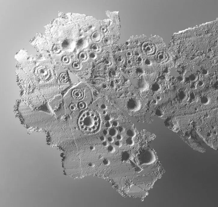
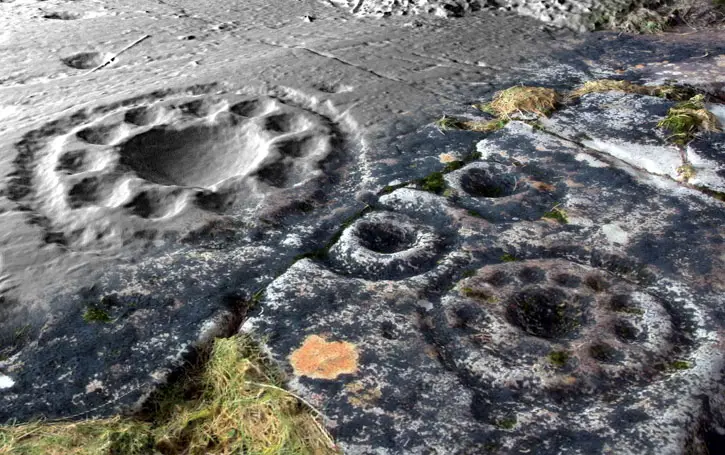
Although we carried out innovative high resolution terrestrial laser scanning on the Neolithic ceremonial rock art at Ormaig in Argyll, we will never know what it actually means. We do know that distinctive circular cup and ring marks were pecked into the stone more than 5,000 years ago. However, are they early examples of family trees? Or are they maps of the stars?
Laser scanning will never tell us why the abstract geometric shapes were carved and added to over time. But by creating a detailed record, laser scanning can help us look after them by monitoring stone weathering and erosion.
This detailed hill-shaded surface model shows two of the main ‘rosette’ motifs:
The same motifs can be seen on this larger plan of the whole panel: