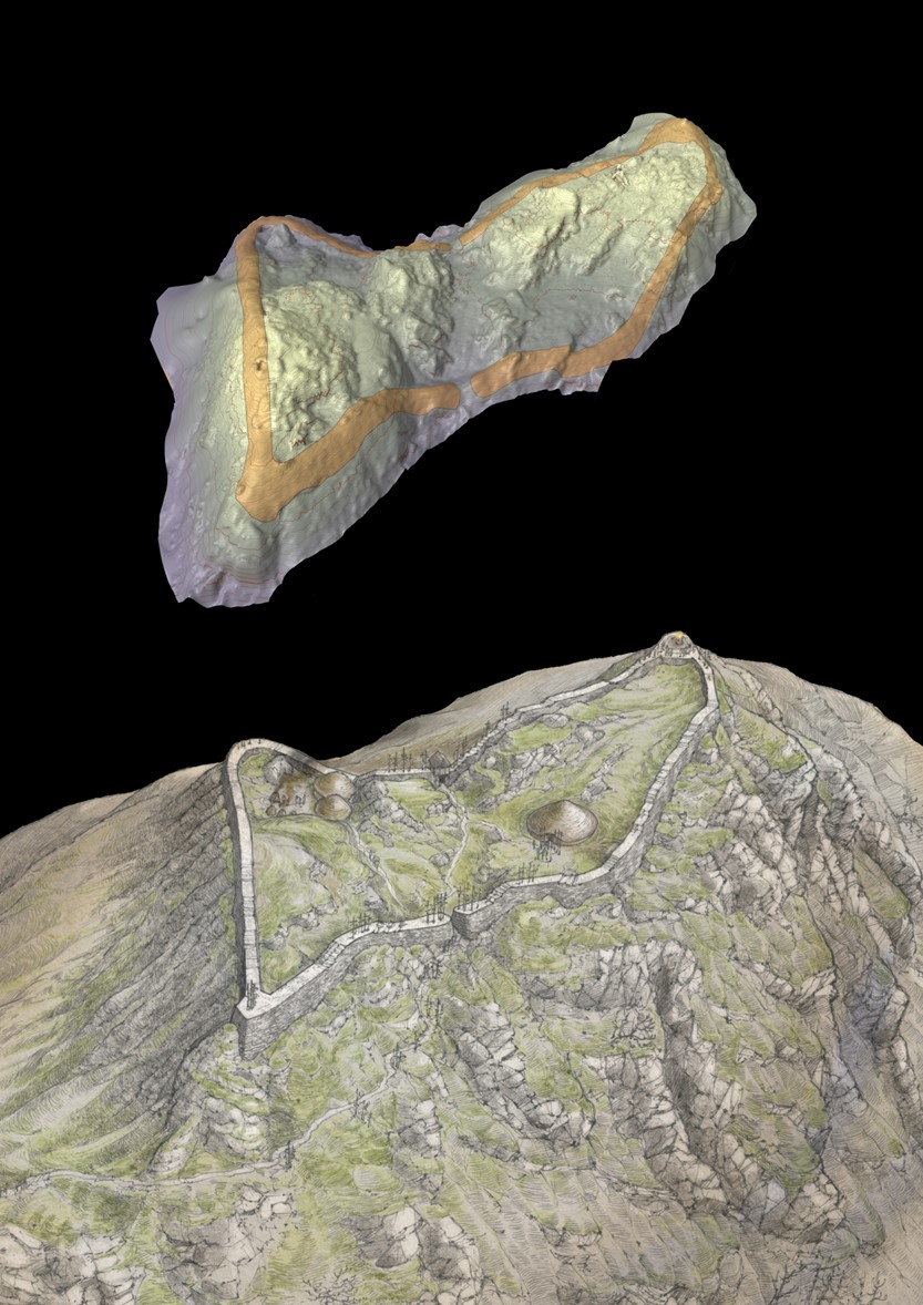
Dun da Lamh is located on a rocky hill at the north-east end of Black Craig. It overlooks the junction of Glen Shira and the River Spey to the north and Strath Mashie and River Mashie to the south.

The interior of the fort covers an area of some 4000 square metres. It is very uneven and includes several rocky outcrops. The east and south sides of the hill are steep and include some vertical crags.

The ramparts are built from small slabs. Part of the original face of the rampart survives above the rubble around all sides of the fort. It is best preserved towards the west end of the fort. The rampart is up to 7.5 metres in width and must have been an impressive fortification.

Dun da Lamh Fort in autumn, the fort is covered in grass and there is a pine woodland behind it.

Although the fort has not been excavated, it has recently been archaeologically surveyed.

Hillforts in Scotland

The majority of hillforts in Scotland date from the Iron Age, the later half of the first millennium BC. Some were also constructed (or reused) in the first millennium AD (the Early Historic period).

When Julius Caesar wrote De Bello Gallico in the middle of the 1st century BC, a first hand account of his Roman conquest of Celtic Gaul, he described contemporary Celtic hillforts, noting that: "they had secured a place admirably fortified by nature and by art."

This eloquent description captures the essence of a hillfort, the builders using both natural topography and well-built defences.

Hillforts were both defensive strongholds and clear statements of land ownership and tribal belonging. Pictish forts in the Highlands likely include the smaller fortified citadels of Craig Phadrig, Tor Dhuin, Dun da Lamh and Dun Deardail. However, few have been properly excavated or dated.

Visiting Dun da Lamh fort

The exact location of Dun da Lamh fort is grid reference NN 582 929.

The best way to access the site is to park at Laggan Wolftrax (please note there is a fee for parking). We recommend you use a map to locate the site accurately. There are several potential routes into the forest.

All sites managed by Forestry and Land Scotland are open for you to explore. However, not all sites have paths or signage and some are a considerable distance from car parking. We recommend that visitors consult a detailed map and wear appropriate clothing.

Please follow the Scottish Outdoor Access Code and remember that historic sites should be treated with care and respect.