
We are currently carrying out a full Land Management Plan (LMP) revision to determine the future management proposals for the forest and land at Glengarry, Craig Liath and Ardochy. This replaces the Forest Design Plans which have recently expired and detail how we intend to manage these areas over the next ten years as well as our vision for future years.
The LMP area lies on the west side of the Great Glen in north Lochaber lying adjacent to Lochs Garry, Oich and Lochy. It covers over 13,460ha of land, most of which is open area dominated by priority habitats including mountain summits and snowbed communities.
The West Inverness-shire Lochs Special Protection Area and Special Site of Scientific Interest (SSSI) affect Loch Garry and the shoreline of Glengarry Forest. Crofting land use occupies much of Craig Liath Forest and includes ancient woodland and bog habitat. Glengarry Forest is impacted by five operational hydro schemes with one consented large pumped storage scheme at Coire Glas.
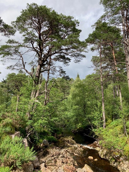
Forested land is dominated by productive non-native species, in particular Sitka spruce and lodgepole pine on a mosaic of soil types, including deep peat. Native woodland designations dominate Ardochy, Craig Liath and the northern part of Glengarry Forest, including the Garry Falls SSSI Scottish rainforest remnant. The main feature of the LMP is the Glengarry Caledonian pinewood, and as such, proposals for its restoration will be the main focus of the LMP revision.
The area is valued by the public as demonstrated by the Wild Land Area and Special Landscape Area designations. Locals and visitors value the core paths, hill access and waymarked trails, which includes Scotland’s second busiest long-distance trail – the Great Glen Way.
We would be pleased to hear from interested parties during this consultation phase as defined in the timelines below. If you have comments, please send them to us using the contact details at the bottom of the page.
Timeline
- 9 September to 14 October 2024: initial public consultation
- September to October 2024: analysis and concept
- October to end of December 2024: prepare draft Land Management Plan
- mid-January to mid-February 2025: final draft public consultation
- March 2025: send to Scottish Forestry for approval
- July 2025: approval
Documents and maps
- LMP scoping brief (PDF)
- Appendix 1 (PDF)
- Appendix 2 (PDF)
- Appendix 3 (PDF)
- Location map (PDF)
- Caledonian pinewood context map (PDF)
- General context map (PDF)
- Key features (PDF)
- Analysis map (PDF)
- Concept map (PDF)
- Concept map - supporting text (PDF)
- Zones map (PDF)
- Current species map (PDF)
- Designations map (PDF)
- Woodland Designations map (PDF)
- Conservation and heritage map (PDF)
Get in touch
If you would like further information or have any questions about this plan, please contact: enquiries.west@forestryandland.gov.scot